It's hard to sum up Patagonia in a few words... We'll let you judge for yourself!
On our return fromEaster Island, we stop over in Santiago for the night before flying on to Puerto Montt ( Latam flight), the gateway to Chilean Patagonia. In three weeks, we'll drive over 3,000 kilometers to reach Ushuaïa at the southernmost tip of the continent.
In the Parque Nacional Los Alerces
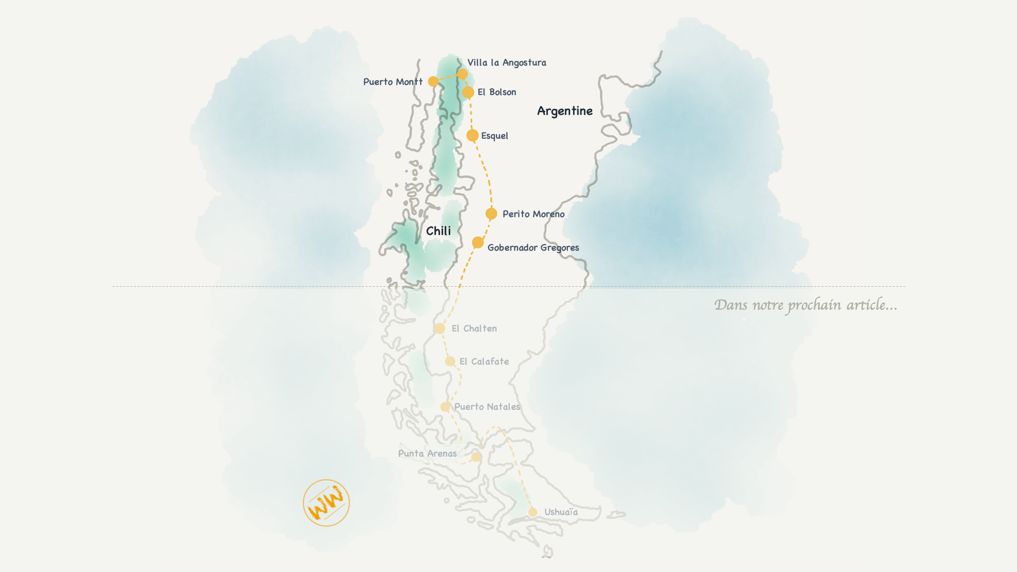
Patagonia from North to South: some information to start with
How to get around?
On both sides, there are many buses connecting the main cities of Patagonia, which are very popular with backpackers. In most cases, they are complemented by shuttles between the cities and the different parks to be explored: this is the most economical way to travel in the region!
We choose to rent a car for more autonomy and simplicity: long distance buses are not accessible and the ascents / descents we opted for in Peru are tiring on the long term. This means of transport has the advantage of allowing us to stop at any time to take advantage of the landscapes and the enveloping solitude of these wild regions...!
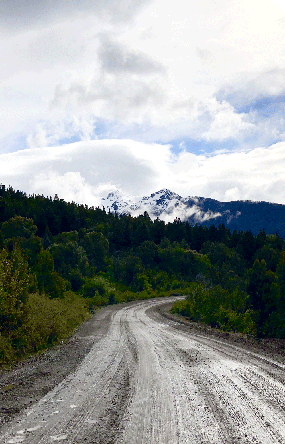
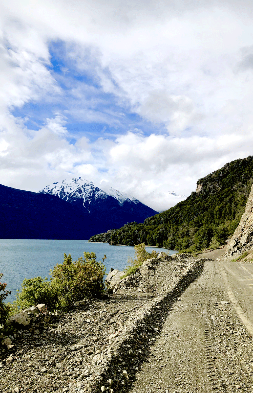
Landscapes of the Ruta 40
Which route?
Patagonia stretches over two countries: Chile and Argentina, separated by the Andes Mountains. If you wish to explore it vertically, you may prefer to go to the Chilean side and follow the Carretera Austral or the Argentine side and follow the Ruta 40.
Punctuated by ferries crossing the stretches of water that cover the south of Chile, the Carretera Austral links Puerto Montt and Villa O'Higgins, a little more than 1200km further down on the border with Argentina. Although it allows you to linger in the many archipelagos that make up the coast, it does not go as far as the southern tip of the country! To reach Tierra del Fuego, you will have to choose between a cruise on a liner or crossing the Argentine border to reach the south by land.
The Ruta 40 crosses Argentina from north to south, linking the Bolivian border and the southern tip of continental Patagonia (before Tierra del Fuego). Over its 5,000 kilometres, it crosses snow-capped peaks and desert plains and links some twenty national parks! Mostly tarmac, it remains as a track in a few places, notably at the southern end of Patagonia.
Our itinerary: one month in Patagonia
There are many border crossings between Chile and Argentina and the formalities are simple with a French passport. It is therefore possible to oscillate between one side and the other quite frequently depending on what you choose to see... To plan your itinerary, find here the list of border crossings and their opening hours.
Some things to consider if you are driving:
A special authorization will be required to cross the border with a rental car (find all our practical advice on car rental in our article "How to rent a car in South America"). How to rent a car in South America "): don't forget to take the necessary steps to avoid being blocked!
Depending on the size of the posts, opening times vary. The roads are long and the areas are often deserted before and after the posts: remember to check the timetables before setting off to avoid getting stuck in the middle of nowhere!
The border crossings are in the heart of the Andes Mountains, at sometimes high altitudes. Depending on the season and the roads, snow tyres or chains may be required, and some roads may be closed in case of major bad weather,
The Ministry of Agriculture keeps a close eye on health risks: no fresh produce (especially fruit and vegetables) is allowed into Chile: don't bring too much food! In the opposite direction (towards Argentina), the rules vary according to the region. Generally speaking, it is better to avoid walking around with fresh fruit and vegetables to avoid having to throw them away at the border...
The petrol stations are far from each other and it is not unusual not to come across one for several hours! If we add to this that on the Argentine side, they are subject to shortages in case of strikes or bad weather... We recommend you to fill up regularly!
Finally, the quality of the roads varies. If some are tarmac and in relatively good condition, others suffer from temperature variations... or have not yet been tarmacked! It is not uncommon to drive many kilometres on tracks to reach the border posts, especially in the extreme south of Patagonia: favour SUVs / 4X4s and check that you have a spare wheel, water and food before setting off!
hhh
We prefer the Ruta 40 which we join at Villa la Angostura from Puerto Montt. We will make a diversion to Chile to explore its southern tip before finishing our Patagonian journey in Ushuaïa, on the Argentine side.
Stage 1: Puerto Montt, at the gateway to Patagonia (1 day, 1 night)
Puerto Montt is a port city without much charm according to us, and will only be a stopover for the night before our departure to explore the Argentine Patagonia.
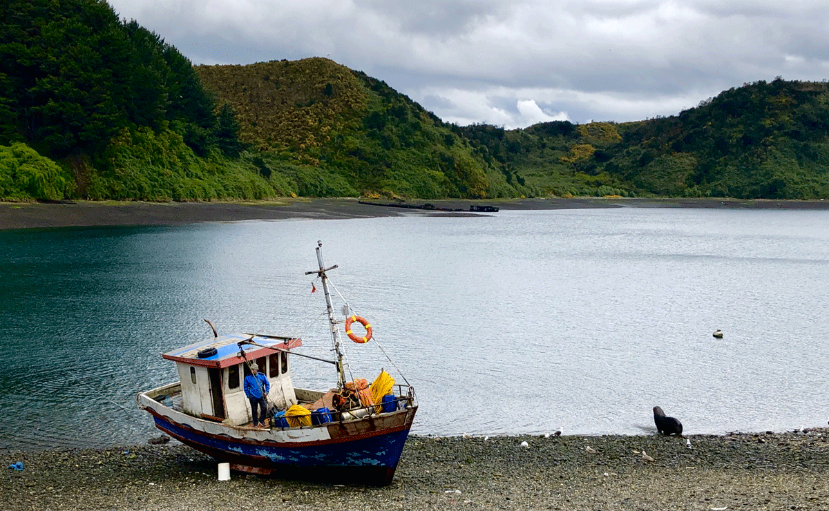
We take the opportunity to walk along the inlet that separates the city from Tenglo Island to Angelmo (20 to 30 minutes walk from the bus station): the ideal place to discover the local handicrafts and taste fresh seafood on the go! A charming fishing village: you can even see sea lions in the streets (beware, they can be dangerous when fish are scarce... Avoid getting too close!).
Our only regret: not having had a few days to make an excursion to Chiloë! We didn't have enough time, but the landscapes of this island still make us dream...
Practical information
Where to sleep?
Located on the harbour, theIbis Puerto Montt offers rooms from €45 per night (double occupancy, including breakfast), including fully accessible rooms.
Where to eat?
It's hard to find a restaurant that stands out from the crowd in Puerto Montt! We definitely prefer to go to one of the stalls of the Angelmo market to have a bite to eat... A good plan for the taste buds as well as for the wallet!
The 7 Lakes Road
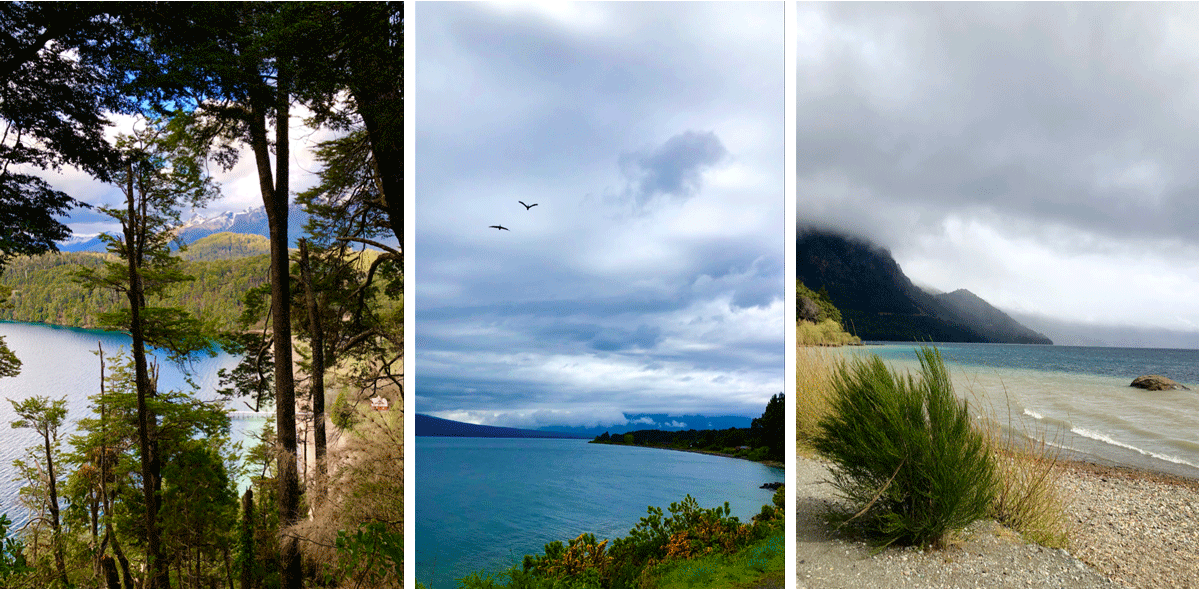
Stage 2: Villa la Angostura and the 7 lakes route (3 days, 3 nights)
After a stopover in Puerto Montt, we headed for Argentina to start our Patagonian journey. Direction : the lakes region ! Enchanting landscapes of luxuriant nature... Tree lovers, this area is made for you !
We spend three days in Villa la Angostura, a charming village with a ski resort atmosphere that will be our base camp for exploring the 7 Lakes Route! This route of just over 100 kilometres on the Ruta 40 leads to San Martin de los Andes and offers stunning views of the lakes in the area (the round trip can be done in one day; to enjoy longer stops at each of the lakes, it is possible to spend a night in San Martin de los Andes).
Please note: the region is rainy and winters are long at altitude! We arrived in early spring (end of October) and visited the area in the rain (or even snow at times). This does not detract from their beauty! The blue water of the lakes under the sun turns into a grey storm while the surrounding mountains are wrapped in white clouds... Patagonia in all its splendour!
Crossing the Cordillera
Practical information
Where to sleep?
In addition to being an ideal cocoon (spacious and comfortable rooms, swimming pool, sauna and massages available on site), the Origen de la Bahia hotel is a small establishment in which we were welcomed in an exceptional way!
Located at the entrance of the city, it is only accessible by private car (or taxi) but it is a haven of peace that deserves to stop there for a few days (85€ per night for two, breakfast included): a great address!
Where to eat?
There is no shortage of restaurants in Villa la Angostura, and we have had nothing but good experiences! On the other hand, we would like to warn you that Patagonia is a land of carnivores: it is difficult to find vegetarian meals! The local speciality: grilled sheep on a spit (or, failing that, trout straight from the local streams)...
Here are some good addresses:
Tinto Bistro for its wine cellars, its tasty dishes and its warm setting (entrance with ramp on the side of the restaurant)
Pioneros Pioneros: for its choice of wood-fired meats to be enjoyed in a "trapper" atmosphere (three steps to the entrance, but the waiters helped us by carrying Peter),
Nanuko An unpretentious brewery with good food and a nice beer list for an affordable price (100% accessible restaurant).
In a wheelchair
Villa la Angostura is a flat town with lowered pavements everywhere: we found the traffic easy and the place generally accessible despite some shops or restaurants whose steps have not yet been replaced by ramps.
The 7 lakes route can be done entirely by car and many viewpoints are accessible by wheelchair. Given the weather, we did not have the opportunity to test many of the hiking trails... But it is clear that if some of them can be used for a few tens or hundreds of meters, none of them is really accessible. Nevertheless, we enjoyed the region without any problem!
Parque Nacional Lago Puelo
Stage 3: El Bolsón, in the heart of the Cordillera (2 days, 3 nights)
From Villa la Angostura: 2h45; 200 kilometres
El Bolsón is a special stop for us, as we plan to make our first paragliding flight there!
Why in El Bolsón? Because that's where theVuelo Semilla association is, which we discovered thanks to Olivia, from We Wheel Rock You (check out her latest projects, she's great! ). These paragliding enthusiasts offer flights with a special wheelchair for people with reduced mobility (free of charge)... And we had every intention of living this crazy experience with them (they also have a branch in the Buenos Aires area)!
Unfortunately, nature decides... And the weather was not on our side this time! Rainy spells and violent winds... Not ideal for a first flight! We take advantage of these three days to recharge our batteries, hosted by Mariela and Martin, where members of the association and paragliders for a day meet in a warm atmosphere... A merry go round! The opportunity for us to discover Mariela's beehives and to taste their delicious Espino Negro honey.
In the absence of paragliding, we also take the opportunity to explore the area! The Parque Nacional Lago Puelo (entrance fee : 350 ARS per person ; free for PMR and accompanying persons) is magnificent and we spend half a day walking around in a dream setting... Even if we have to be content with taking the paths reserved for cars, the hiking paths being sandy and/or too narrow...
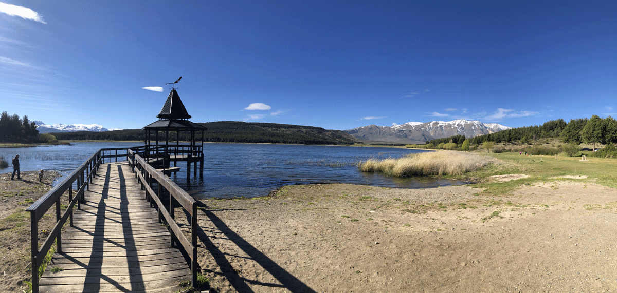
Parque Nacional Los Alerces
Stage 4: Esquel, at the foot of the mountains (2 days, 3 nights)
From El Bolsón: 2h20; 170 kilometres
Stop in San Carlos de Bariloche, the "Argentine Switzerland" to enjoy the view of the Nahuel Huapi lake from the Circuito Chico peninsula which crosses the peninsula...
After three days of rest, it's time to head for our next stage: we leave the Cordillera to reach the plains, towards Esquel! This city, criss-crossed by wide avenues, marks the border between the Cordillera, the green plains that surround it and the semi-desert territories that extend to the south, as far as the eye can see.
If the city itself is not really interesting, neither for its aesthetics nor for its atmosphere (we didn't find any really nice restaurant there), its surroundings are rich in various natural attractions... Some of which we really liked!
Practical information
Where to sleep?
Let's be clear: finding an accessible hotel in Esquel would be a miracle! Among a very limited selection of hotels with lift (but without accessible bathroom), we choose Las Bayas: a very comfortable hotel with an excellent breakfast but whose prices are a bit above the local average (90€ a night for two, breakfast included)...
Where to eat?
If we were not conquered by the local gastronomy, we found a warm welcome at the Blest, a brewery where you can taste good beers if you can't find original dishes... And which has the advantage of being completely accessible.
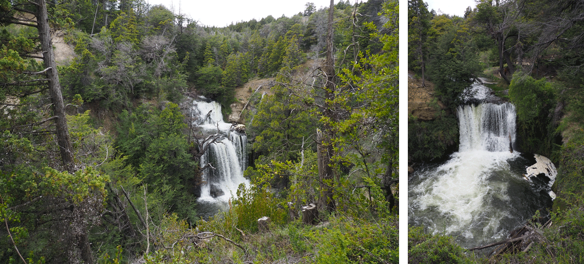
Waterfalls of the Parque Nacional Nant y Falls
We recommend
Here is a selection of our favourite activities during our stay there!
Note: theEsquel tourist office has a handy, detailed map of the area's sights and activities (many organised excursions are possible, including the exploration of ice tunnels, which we were tempted to do... but was not accessible). Don't hesitate to come and see them at the beginning of your stay! Excursions fill up quite quickly in high season and are often conditioned by the number of registrations in low season... In either case, it is better to book a little in advance!
1. Explore the Parque Nacional Los Alerces (1 to 2 days)
From Esquel: 1 hour; 50 kilometres Free
One of our favourite places in this region! The Parque Nacional Los Alerces takes its name from the hundred-year-old trees that populate its forests. The park is crossed by a track (you can take it from El Bolsón to get to Esquel) which reveals grandiose landscapes at every turn, a mixture of immense lakes, dense forests and rocky cliffs.
The ground was soaked by the recent bad weather that we didn't have time to explore it on foot, but the park is worth a visit! You can drive through it in half a day (taking time to stop and look at different viewpoints) but one or two days are necessary to fully enjoy it...
2. Discover the waterfalls of the Nant y Falls Reserve (1 hour return)
From Esquel: 50 minutes; 45 kilometres
Admission: 200 ARS; free for PRM
A short and easy walk (1 hour round trip if you take your time) along dirt paths that lead to three waterfalls, the most remote being the most spectacular.
In a wheelchair: the three platforms that allow you to see the waterfalls have steps (several for the first, a very high one for the second, many for the third):
The first waterfall is not visible from the path,
The path is relatively passable for the first 200 metres (it is still dirt and sloping), which gives a good view of the second waterfall,
The third waterfall can be partially seen, but the path becomes steeper and more difficult after the second one (brambles on the sides, roots and some stones in the middle).
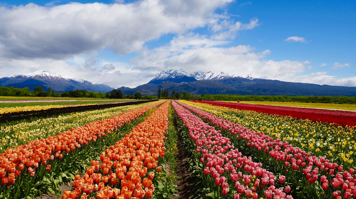
Trevelein tulip field in bloom
3. Marvel at the colourful Tulipanes of Trevelin in October (1 to 2 hours)
From Esquel: 45 minutes; 40 kilometres
Admission: 400 ARS; free for PRM
The window is short, but the view is worth the diversions! At the foot of the mountains, this tulip field offers an exceptional spectacle during the flowering period (the flowers are cut in the first days of November): the rows of brightly coloured flowers stand out against the black and white background of the Cordillera...
In a wheelchair
You can easily walk around the field on the packed earth paths.
4. Walk the shores of Laguna La Zeta (30 minutes to 1 hour)
From Esquel: 15 minutes; 5 kilometres
A popular walk for locals at weekends, who mainly come to enjoy the setting for a family picnic. The lake is not swimmable but the view of the mountains is magnificent: a good place to get some fresh air in a quiet environment!
In a wheelchair
The path, which is sometimes dirt, passes through grass in some places and sand in others... It is better to be accompanied!
Cueva de las Manos Valley
Stages 5 and 6: Perito Moreno and Gobernador Gregores, the stage towns
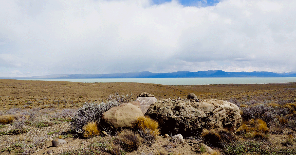
The Ruta 40 stretches as far as the eye can see and the plains become deserted as we head towards the glacier region. It's hard to do the route in one go for so many kilometres!
We decide to cut our itinerary to anticipate the unforeseen events that could slow us down (road in bad condition, puncture on the track, sandstorm... and we did well)! Our objective: to limit fatigue and ride as little as possible at night. For that, we will make two stages before reaching El Chalten, our next destination:
Dinner at Fusion 40 cozy pizzeria (accessible entrance)
Perito Moreno - Gobernador Gregores
400km; 5h30
Overnight stay Parador Ruta 40 45€ for two, breakfast included
Dinner at El Chichoa pizzeria again (accessible entrance)
On the road: classified as a UNESCO World Heritage Site, the Cueva de las Manos cave is a site of rock paintings which is obviously worth a visit... The cave is not accessible (descent via a staircase on the cliffside), but the mini-museum on the local fauna/flora and the history of the site is (a few square metres). Access is via a track from the Ruta 40 (about 45 minutes), and visits are conditioned by the weather (cancellation in case of high winds due to risk of falling rocks).
Gobernador Gregores - El Chalten
300km; 6 hours (mostly track)
ddd
Please note: in these regions, restaurants close early, especially in low season! It's best to plan your meal if you're planning a late stopover...
In our next article
El Chalten marks our first steps into the glacier region. After crossing arid expanses with only families of guanacos for company, the snowy peaks reflected in the turquoise waters of these immense lakes leave us speechless. The cold of winter gradually gives way to spring, while snow showers remind us that nature chooses its own time. Around Mount Fitz Roy, forests and rivers form a green setting that we instantly fall in love with: the wilderness here takes on another form, whose raw beauty overwhelms us...